

Incoming mission / Los Angeles
Click the envelope to open your letter.
Dear Mission Designer,
Los Angeles needs your eyes in space.
Detect active wildfire cells quickly enough to support community evacuation planning.
Smoke and clouds cover parts of the fire zone. We need your first useful observations within 8 hours.
— Los Angeles research team
Fictional educational mission request
Open the full flight brief and science sources
Mission control / priority uplink
● ACTIVE TRAINING SCENARIO
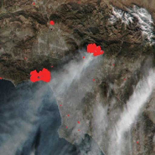
Wildfire alert: Los Angeles
Strong Santa Ana winds are pushing fire through the hills above Los Angeles.
Why space? Smoke and clouds cover parts of the fire zone. Your spacecraft must find useful observations and transmit them to the ground team.
Archived NASA imagery · not a live emergency · source & date ↗
Mission science, assumptions & data sources
What the mission models
Find the active fire and get that data to emergency managers within 8 hours.
Thick smoke and some clouds hide the fire from ordinary cameras.
Results come from the deterministic simulation. Surface temperature is different from air temperature, and radar does not directly measure surface heat.
Source provenance
- NASA FIRMS VIIRS 375 m active fire detections, Suomi NPP and NOAA-20 (via NASA GIBS) · NASA-observed reference · Fire cells and their first-detection day come from VIIRS 375 m thermal anomaly detections, 7-13 Jan 2025 (Palisades, Eaton, Hurst and Kenneth fires). The mission runs 8-13 Jan UTC (day 0 = 8 Jan); cells already burning on 7 Jan start on day 0. Persistent industrial heat sources are masked with a Nov 2024 baseline. Smoke/cloud blocking and sensor detectability are modelled.